|
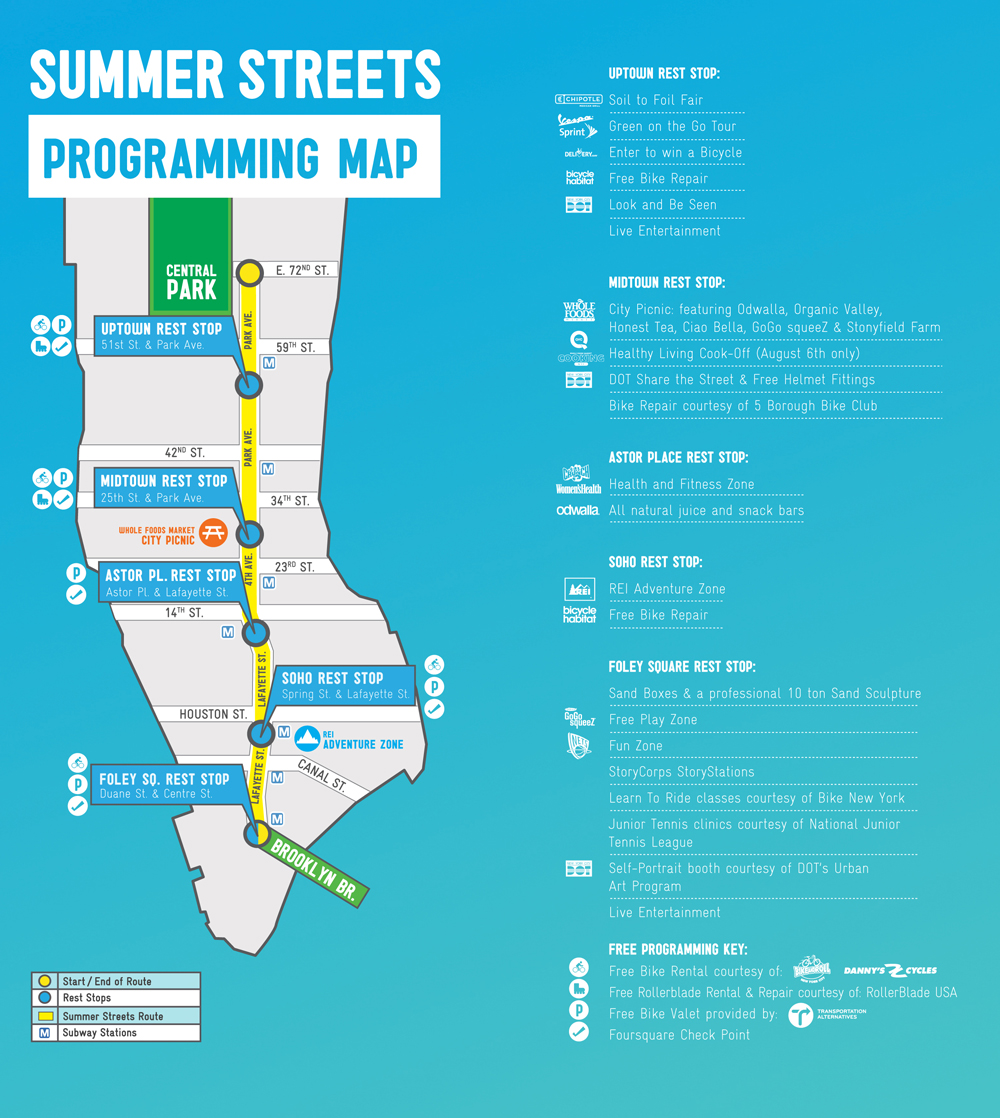
I want to use Google Maps to show the exact route from Brooklyn Bridge to Fifth and 72nd that the city opens up for the Summer Streets event. The map they do for the event is a GIF. Not too precise. But they won't let me drag the route to places it should go, because on normal days you can't ride bikes there. Like the upper-level road that goes around the Grand Central Terminal building. That's strictly an auto thing, says Google. Not today it isn't! Oy. For some reason I think I should be able to do this easily. It's reallly well-organized in my head. Brooklyn Bridge to Center St to Lafayette to 4th Ave to Park Ave S around Grand Central, onto Park Ave (a really nice long downhill). Left on 72nd. Finish at 72nd and Fifth. Boom. That's it. |
|